Saturday, August 29, 2009

Day 25 Indiana Heat and Hills Vincennes – New Albany, IN 118 miles


Friday August 28th was a tough, tough day. There is a theme here: heat
and hills make for hard work on a bike. This was the third day the
forecasts called for it to be about 10 degrees cooler than it really was.

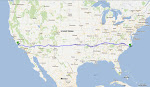
East of Vincennes I took US Route 50 for 25 miles. What a great road, I
thought, wide shoulders, smooth, I was just going to turn my mind off and
pedal straight into Louisville and meet my wonderful girlfriend Paula at
the airport on that city.

About noon the plan changed abruptly. Route 50 went to 2 lanes and zero
shoulder. A desperate phone call on the side of the road to find
alternate routes turned into a lesson how to use a cel phone when one can
hear and feel trucks rumbling by. Where do all the Illinois and Indiana
18-wheeled trucks come from? – I feel like they are morphing out of the
corn. Suddenly, the sheer volume of trucks was apparent to me when I lost
my shoulder.

The long afternoon featured a detour along pleasant but shoulder-less
roads – roads that at least had somewhat lighter traffic volume and
generally courteous drivers. I am now near the home of the famous Dan Patch, an Indiana horse that became at the turn of the twentienth century. At one point in the afternoon, I stopped to great some horses which distracted me from the pain I was feeling.

Southern Indiana gets hilly! I cut right
through the Hoosier National Forest and negotiated some short but very
sharp hills. One hill out of Celestine was 10 percent grade. With air at
95 degrees and humidity to match, wow, that was a challenge. All day and
every hill I tried to wrap my mind around the fact that the previous 48
hours had been some of my flattest days of the trip. That was over and I
suppose will be until I pedal somewhere east of the North Carolina
Triangle. I reached New Albany just as dark covered the sky.

There is still a lot of pedaling to go to get to Atlantic Beach. This
weekend’s plans include another trip to the bike shop, eating, sleeping,
and eating some more. The challenges start anew on Monday. Kentucky is a
populated state with a lot of traffic. The adventure continues and the
legs will have had their time off the pedals.

Friday, August 28, 2009

Day 24 Plana, IL – Vincennes, IN 125 miles


Everything felt like glue this morning. The humidity was glue, the heat turned the cement to seeming glue, and my legs were glue. Plus about 3 hours sleep on top of that. Needless to say, it took a while for the engines to fire today. I rested on a ’59 Allis-Chalmers for a bit. I thought the bucket seat would provide some relief to my saddle sore, but the cushion was just not there.

The bulk of the day was similar to Day 23. Flat, hot, humid, and corn, corn, and corn. The sun just pounded me and a thunderhead could really never find the sun to cover me with shade. But I just chipped away and my destination was only 35 miles away at 5 PM.

The folks were friendly to me today. The postmaster at Effingham, IL was waiting for me with a care package from my folks, with a stunning volume of food in it! He gave me a Gatorade because I must have looked parched. The owner of Joe’s Pizza gave me a free pie. He was a generous man. On the wall of his pizza parlor hung a picture of him and the mighty Pujols, one of the best ballplayers in the land.

In the evening, the hot sun faded and the road got smooth. I made much better time and pushed hard for Indiana. The southeast section of Illinois is very pretty, with the forest making a comeback from farmland a bit. The trees are a confused by pretty mix of north and south: cypress, red maple, sugar maple, white and red pines, oaks, and gums, to name a few. Across the Wabash River and time zone at dusk, I got utterly pelted by bugs, to the point I had to re-apply my sunglasses. At dark I pulled into the Knox Indiana County Park and had a friendly family pick up my camping bill for the night. The kindness of strangers has helped me greatly on this journey.

Thursday, August 27, 2009

Day 23 Planes, Trains, and Bike across the Grainy Plain Pittsfield – Plana, IL 113 miles


I got a gift today: no wind and the flattest day of the trip. I realized that the bluff country around the Mississippi at the end of the day yesterday gave it that New England feel, but today it got really hill-less. It probably gave me 20 more miles that my legs otherwise did not have. Even though it was hot (low 90’s), this kind of flatness allowed me to get in a cadence I could sustain for a long time; Now that my resting pulse is 40, a flat road allowed me to just turn pedals over with little difficulty except the eventual fatigue of the legs.

This weekend I have planned to stop for two days in Kentucky. I have never been there. It will give me to rest before the push over the Apps. I passed a stunning amount of corm and soy, but no wildlife. Corn is so abundant here that the 10 foot high stalks serve as a windbreak if they are planted close enough to the road, and they are. Trains are quite the presence out here, hauling grain and coal in many directions. The noise this engineer made almost suggested the locomotive had never been photographed before.

The closer I get to the east coast, the more I am struck by the vastness and diversity of our country. In six hours time a plane took me all the way across the continent, and now over a month to get back. Sometimes I’ll peer into the sky and wonder where all the vapor-streaming jets are headed. A few hundred miles east of Denver, I thought a pack of them were headed there; for a moment I wanted to turn around and follow them since Colorado mountains are familiar and attractive territory to me.

Of course, the diversity of people in the U.S. is as stunning as the diversity of landscapes. I wondered what this food store sign would say of it was in Newport Oregon; maybe dungennes crab and geoduck clam. In Sneads Ferry perhaps it would say shrimp and oysters. Anyway, I was perfectly content to pass on the store specials and kept riding through the miles of corn. My legs might be starting to resemble frogs legs right now.

Out of nowhere, for the last 20 miles of my trip, I caught a bike path that paralleled the road. After getting passed by thousands of trucks, it is a treat the find a bike path and turn my mind off to the traffic. The first autumn mulberry and alder leaves are falling and the crickets serenaded me as I pedaled on.

Tuesday, August 25, 2009

Day 22 Mississippi Crossing Clarence, MO – Pittsfield, IL 89 miles


Today I crossed the big river. It felt good. I felt like I had gotten somewhere, a landmark by which I could judge my progress. A river this big makes one pause. It was a scene to behold as I peered southward down the serpentine river body. I thought of how far I was from its Minnesota forested beginnings, and how far I was from its Gulf terminus. If it could talk, the old Mississippi would have a lot of tales to tell, about floods and droughts, spills and clean-ups, and lives it has touched. Mark Twain was one.

I have always been taken by rivers. They just seem alive to me. It must be their motion. The more turbulent the river, the more it captures me. I think the same goes for the rest of us. Big waterfalls grab our attention more than slow, serpentine backwaters. I have been at the very top trickle of two mighty American rivers, the Green and the Hudson. At the top of each, I wondered how many character changes each undergoes before it merges with another, or before it rests at the ocean.

Today was a good day not just because I crossed the Mississippi but because I got absolutely pasted by heat and headwind. I say this is good, because I was forced to resign myself to the fact that the weather give and also take, and my legs are feeling pretty tired. I just had to go slow the whole day – in the morning on account of a 30 mile long gravel shoulder and in the afternoon on account of temps and winds. In western Illinois, I traveled a back road and saw familiar things: deer drinking from a stream, a big red tailed hawk circling the skies, and my first sugar maple trees of the trip. The road (Illinois 106) kindof had that New England feel to it with its well maintained farmsteads. Things felt familiar again. The town where I found a campground for the night - Pittsfield - has a pulse. The county courthouse in the town square is as stately a building as I have seen on the trip. Finally…east of the mighty Mississippi.

Day 21 Route 36 Hamilton – Clarence, MO 111 miles


I have been on Route 36 for almost a week. The changes to the landscape are subtle but steady. The land has become less arid. The trees have returned. Last night I pitched my tent in a grove of shagbark hickory and poplar, two species found in the east that would have been missing from the sage-covered hills in dry Kansas and Colorado. All night I heard great horned and barred owls. If I am not mistaken, the barred owl needs some serious woodland as part of its home range. Two of them seemed to call back and forth to each other at varying distances from the tent. Later, coyotes chimed in; they would start and stop howling pretty spontaneously. All those noises didn’t seem to bother a raccoon, who got into my pack but missed the granola bars before he was shooed off by the biker.

There was some serious headwind on Route 36 today. The shoulder improved greatly for biking over Sunday’s conditions. Late in the day, however, the four lane road got reduced to two lanes and zero shoulder. I was not thrilled about that, and actually got up and used the closed two lanes under construction (photo). For a while I was feeling great about it; the road was completed enough that I could bike on it but it was closed to motor traffic. It was the last 12 miles of the day and I was glad to zone out. Then, with about six miles to go, the construction became so recent that the concrete was still wet! I had to hop on the shoulder-less other section again. Dogs chased me and I had to ride opposing traffic to find any shoulder at all. Alternate routes eastward through Missouri are very hard to find right now, so I will have to tread carefully tomorrow. There is a difference between biking and holding on, which is what I did for a bit. This is supposed to be pedal4wildlife, not pedalformylife!

Obviously the eastern U.S. is much mire heavily settled than out west, with the bulk of the unsettled land, at least here in Missouri, under intense cultivation. I have been seeing very little wildlife during the day. This is the section of the country I thought I’d have to put my head down and plow through, and this has been the case. When we were running the beautiful carriage paths of Acadia National Park, my Maine buddy Tim Sheehan once told me that when he got tired, it helped him to picture his muscles at work. Today that is what I did. I looked down at my quads and visualized the repeating firing of muscle fibers, and that energy transferred to the tiny pedals below. I thought if my transformed legs acting as two smooth pistons that slowly but surely turned feet into yards, and yards into miles, on a ribbon of concrete cutting through a sea of soy and corn.

Monday, August 24, 2009

Day 20 Leaving Windy Kansas Seneca, KS – Hamilton, MO 108 miles


Today I left pretty Kansas. Route 36 was a good road for riding, and the motorists were super friendly. I was surprised at how hilly the whole state was. Route 36 does not skirt hills; it cuts right through them. I was fortunate to see another falcon again yesterday.

I got drilled by headwind all day, so the law of averages struck. I was fortunate through Kansas to have side or slight tailwinds. In fact, on the whole ride the wind has been very good to me. Today I cannot remember coasting at all, even on any downhill. The wind just makes a huge difference in cycling. One thing the headwind did for me was kept things cooler than they would have been otherwise. At least the weather has been reasonable; folks keep on saying that normal August temps are typically around 100 F. In the middle of the afternoon I crossed the mighty Missouri River. I have been to the icy clear headwaters of the Missouri up where it starts in Montana. It certainly goes through a lot of landscapes as it winds to the Mississippi.

My progress slowed considerably in Missouri as the shoulder got rough. About 7 PM I had to get serious about finding a place to sleep. I called up a campground well off the main drag and they gave me directions to a place well off my route 36. So I took as very hill country road over broken farmland, which added another 8 miles – a lot when one is tired. It was a very pretty ride on a very quiet farm road. As I made my way closer and closer to the campground, I wondered if I’d ever get there! Then the road turned to dirt and just kept on going as light left the sky. Finally got the small campground at dark, and heard owls and coyotes nearby as I fell asleep in the middle of nowhere in northern Missouri.

Saturday, August 22, 2009

Day 19 The Hills of Kansas Mankato – Seneca, KS 115 miles


Today was a tough day. I think Kansas has a perception of being flat because one can see a long way without tree cover. A straight road, such as Route 36, is going to cut across rivers as opposed to paralleling them like roads in the mountain west do. The arid west is gone. The humidity is back. Corn and soy fields are everywhere out here.

The Kansas folks are very friendly. I wonder about the state of things here; many towns look semi-deserted. I will have to investigate the reason why. A lot of streets have beautiful homes that sit unoccupied. When today I biked past my first Wal Mart in a week, it caught me by surprise.

It was really a good day for pedaling. I had yet another day of blue skies and no wind in the morning. Then in the afternoon the headwind kicked in and my fortune changed. The hills and wind finally caught up with me. Enroute today I was fortunate to see a couple species I have seen in many parts of the continent, and the first sightings of this trip: great egrets and red shouldered hawks. I always get a kick out of species that I have witnessed in extremely diverse sections of our country.

From what I can tell, this is not an area where bicycling is very popular. So I have not many folks who are – or who can appreciate - bike touring. That changed tonight. I met two sisters who are carting rickshaws from Michigan to Colorado. Very inspiring. They donated money to the Outer Banks Wildlife Shelter. I was very touched by their gesture.

Friday, August 21, 2009

Day 18 Pedaling East of Center Oberlin – Mankato, KS 126 miles


Today I didn’t feel as though I had it, and the pretty good side and headwind made pedaling much more of a challenge than 24 hours earlier. By noon I had made 35 miles. I had to remind myself to just keep on turning pedals over. But that’s life; there are ebbs and flows to any great endeavor. Route 36 is not flat, far from it. The climbs are not as steep or long as those in the Rockies but they are there nonetheless. The headwind is its own sort of hill. I met two day riders that said on racing bikes they had been reduced to 6 miles per hour on a bike in Kansas. That’s wind…kindof like the Gulf Stream in winter.

Ever so subtly the environment has become less arid. I realized part way through the day that I may have seen my last sage of the trip. I saw little irrigation equipment today. I think most of the crops growing around here – corn and soy today – are fed by rainfall. The sunflower fields have disappeared for the time being. Deciduous trees are making an appearance, and I recognize oaks and ashes found commonly father east. There was very little wildlife today. The big exception was a pretty farm pond that had half a dozen terns – grayish backs - looking for fish.

Late in the day I pedaled past the geographic center of the country. I suppose that I am now officially in the east! The map (photo) didn’t have many cities listed on it, but did have two that I know well – Raleigh and Bangor, Maine. They are still a long ways off, but each pedal revolution brings me a bit closer to Bogue Sound watermelon and channel netted shrimp.

Thursday, August 20, 2009

Day 17 Great Plains, Grains, and Seeds Yuma, CO – Oberlin, KS 138 miles


A very good day of pedaling. For roughly 50 miles today I heard the rare sound of the chain around the rings. This means that the effective wind speed around the bike was zero….a 20 mile per hour tailwind and a biker going in the same direction at the same speed. Very nice. Near the Nebraska border I saw two tourers heading into that same wind towards San Francisco. Two very nice guys recently graduated from Goshen College. We had a great chat about routes, bikes, and journeys. It always energizes me to meet people who live all the way up. They’re not hard to spot.

I had expected the bulk of the day to be similar in terrain to yesterday but it was actually quite different. I crossed briefly into Nebraska and that wonderful cooling wind blew me straight down the cottonwood draw of the Republican River. Then I headed south on Kansas Route 161. Beautiful fields of sunflowers and wheat bending with the Keewaydin wind that howled across the prairie. I finally felt like I was in the bread basket of the world, that section of our wonderful country that feeds billions of people their food. For a time today, everything seemed pointed in the same direction: my bike, my hunched body, and millions of stately sunflower and corn stalks bending to the east.

Northwestern Kansas is surprisingly hilly. Route 36 has a lot of ups and downs. On tops of some of the hills, one can see for 30 or 40 miles across great open farm and grassland. The road was smooth, so each downhill blast of speed propelled me back up the next roller coaster hill with yet another wonderful view. More motorists waved at me today than any other day of the trip. August 20th - 17 days into the journey – I finally felt like a bicyclist.

Day 16 Windmills, Sunflowers, and Flat Roads Briggsdale - Yuma, CO 116 miles


The change in culture and topography is stunning. Indeed, Colorado has two halves, and they are starkly different. I am getting to see both at a very slow pace.

This morning I awoke to the sound of coyotes in the Pawnee National Grassland, then set about finding a phone to call back to North Carolina radio. Fortunately, the hour was not too early for a truck driver eating his bowl of cereal. All day I headed east; for just as long, the wind blew out of the north. I tried to will it to turn 90 degrees to the west, but it never happened. The August prairie sun beat down on me with intensity, and I grew more tired, and sooner, than I thought.

I wondered how different the landscape would look and smell if it was not under intensive livestock production. I passed numerous livestock feed lots enroute east towards Kansas. I wondered whether this production was one of the reasons I saw such little wildlife today, the least of any day of the trip. The Pawnee National Grassland protects a very small portion of native prairie habitat, so it is not surprising that I saw a great number of bird and mammal species on my ride through there yesterday and stopover last night. That grassland is home to the mountain plover, a species that is similar in appearance to piping plover.

I was fortunate to see several species of buteos today. Perhaps they are color variants of the same species, for the bulk of the ones I am seeing have a similar body shape and wing span. When I was zoning out during one stretch today, I suddenly was alarmed by a loud screech just above my head. Evidently I had biked too close to a nest and the hawk let me know about it from very close range. Also noteworthy today was the roadside vegetation, including abundant wild sunflowers. This provided good scenery on a ride that was otherwise hot, flat, and straight through the beginning of the American midwest.

Wednesday, August 19, 2009

Day 15 Eastward Bound Gould – Briggsdale, CO 120 miles


A rich and varied day of pedaling. In the cold morning at Gould (30 F) I awoke to bike maintenance still undone. My replaced spoke had to be trued, and I decided to go with the thinner tires that I had been riding the bulk of the trip. In a small kitchen in the campground in the morning I replaced the front tire and tube. Something went wrong because the front tube blew out upon replacement – like a shotgun blast in a small room!

A brief talk with my bike mechanic in Pennsylvania relieved my fears about doing the spoke replacement improperly. Then I was off. Cameron Pass from the west side was not too bad since I was starting in a town this morning that lies at 9000 feet elevation. I stopped at the pass for a bit. I realized that the last climb in the Rockies had been completed. A large part of the trip - the American Rockies – had been accomplished.

The bulk of the day was spent on a wonderfully long and gradual descent through the Cache La Poudre River Canyon. This is a spectacularly beautiful river corridor. The transition from spruce and firs to arid-tolerate pines and junipers attested to my significant drop in elevation as the ride progressed. This river ranks as one of the prettiest I have seen; tremendous boulder-strewn rapids followed by long tail-outs where the water runs as clear as gin. The riverside mountains are a jagged formation composed of rocks and cliffs of all shapes and sizes.

The friendly folks at Full Cycle bicycle shop in Fort Collins gave my bike wheels a through examination while I toured the city a bit. Fort has a similar feel and appearance to Corvallis, another town I pedaled through on this trip. It is no coincidence that the two towns share a similar verve, for they are both home to major public universities with good reputations. In the bike shop I spoke to a wildlife professor at Colorado State University. He had praises for the school for which I now work.

Fort Collins and cities south – Boulder, Denver, Colorado Springs – lie along the Front Range of mountains, and thus sit at the sharp boundary between the Mountain West and the Great Plains. In the late afternoon I left town and started east. I was sad to see the mountains go. The greater the challenge, I believe, the more poignant the memory; the visions of steep, twisting climbs into the thin air of Santiam Pass and Flaming Gorge will stay with me for a long time. As twilight faded to darkness on the long straight road ahead, a rich light developed over the Front Range. I kept craning my neck over my shoulder to have another look at Longs Peaks and its mountain neighbors off my back. I didn’t want to see them go.

Tuesday, August 18, 2009

Help me pedal my way to 10K!


Thanks to all of you who have generously shown your support of my solo bike tour and the Outer Banks Wildlife Shelter (OWLS) by sending words of encouragement, donations to my cause, and packages with goodies. Your kind words have helped to keep me pedaling through muscle pain, inclement weather, steep hills, and mechanical issues.

It’s been 1500 miles, five states and almost $5500 dollars. I’ve raised just over one-half of my $10,000 goal and I only have less than 20 days left pedaling. I am beginning to wonder if I am going to attain this 10K goal at the rate that donations are trickling in. I hope I am able fulfill my dream of helping OWLS fund a large enclosure in which to rehabilitate larger mammals such as the white-tailed deer pictured here.

Remember – for a $50 donation, you’ll receive a Pedal4wildlife t-shirt; $100 – a t-shirt and a sweatshirt, and $250 – a t-shirt, sweatshirt, and Outer Banks Wildlife Shelter canvas tote. Donations to OWLS are tax deductible.

To make a secure online donation to my cause, click the donation link in the right-hand sidebar of this webpage or visit http://www.pedal4wildlife.org/. Alternatively, checks can be mailed to the Outer Banks Wildlife Shelter at 100 Wildlife Way, Newport, NC 28570. Note “bike tour” on your check.

I realize economic conditions make it difficult for some to consider donating money. If this is the case, please consider giving back to your community by volunteering a small amount of your time during the national United We Serve campaign. Together, we can make a huge impact in our communities.

Other ways to help this cause:

*Send the http://www.pedal4wildlife.org/ link to all of the email addresses in your contact list and ask them to donate.
*Join my Facebook Cause and invite all of your FB friends to join, too.
*Post a link to this blog on your Facebook page or use the “share” function at the bottom of any of my blog posts.

Thank you for your overwhelming kindness and generosity. The orphaned and injured animals at the Outer Banks Wildlife shelter thank you, too.

Monday, August 17, 2009

Day 14 Trying to punch through the Rockies Steamboat Springs – Gould, CO 78 miles


I will call this Day 14 of the ride. And it was an uneven day of riding, one where I never really got into a groove. Got a late start out of Steamboat Springs. I’ve been riding with a busted helmet all trip, courtesy of UPS shipping. So I got as new one in the Springs, and also picked up my bike after major repairs. Indeed, I have been putting some torque into the pedals lately, and it was time to have the machine inspected.

There are two passes to exit the Rockies from Steamboat. Around noon I started to climb Rabbit Ears Pass, a long slog (~8 miles) at about 6 percent grade. I then entered a beautiful mountain valley between the Medicine Bow Mountains and the Front Range. Sixty miles went down pretty easily and I thought I’d have a shot by dark to take Cameron Pass, the last obstacle heading east before sliding downhill enroute to the still-faraway Mississippi.

Outside of Walden I heard a ‘snap,’ and looked down to see a broken rear spoke. I then limped into Gould, pedaling gingerly to avoid any wheel catastrophes. Now, at close to midnight local time, I wonder whether my repair job will suffice. Fort Collins and reputable bike shops are 80 miles away, and the other side of Cameron Pass. Certainly there is no good time for a breakdown, but I have been very fortunate with the bike in over 6000 miles of bike touring.

While the day was cut short, it was nonetheless a wonderful ride. The high temperature was roughly 70, and I was buoyed by a west wind for a good deal of the day. A beautiful glowing sunset laminated the cloudy Front Range I was pedaling towards. I saw numerous large mammals: antelope, mule deer, and my first elk of the trip. The mountain valley in the Walden-Gould area is spectacularly beautiful.

Tomorrow, bike, body, mind, and traffic willing, I will try to pull off a long gainer. On the steep climb up Cameron Pass I will hope that that the only sound I hear is the gentle hum of the chain on the rings and my heart pumping heavy to the top of the Continental Divide. I left some energy in the tank today. It is time to see the American grain belt.

Friday, August 14, 2009

Day 12 Barren Ground and Big Hill - II Flaming Gorge Reservoir Dam , UT – Maybell, CO 129 miles


In the morning I awoke to cows mooing near my tent. After a quick pack-up I ate breakfast with some friendly folks from Salt Lake City. They prepped me for what lay ahead, and I was not particularly thrilled by what I heard – hills and a long way to my destination, Maybell.

First thing pedaling I had to try to exit the gorge basin, which meant going uphill into a biting headwind on a rough road. After eight meager miles, Paul needed a time out. I stopped by a meadow stream at about 8000 feet elevation and carefully walked its cutbanks looking for trout. Sure enough, there were quite a few, and I could hear their slurping of grasshoppers that hit the water. The mental reset at the trout stream helped.

It was a very hilly day. Yesterday I remarked that the hill on the west side of the gorge was the worst I had biked, but that certainly there are ones worse still. I was reminded off this dropping off the back side of Flaming Gorge going south on US 191 towards Vernal, Utah. Just a monster hill, maybe not quite as steep as the one I took on Day 11, but about twice as long. I could feel the temperature increase by about 15 degrees on the way down it, as I lost rough 3000 feet of elevation.

I reached a very hot Vernal at noon and still had 90 miles to go when I left there at 1 PM. The next 30 miles were very tough heading east on US 40; headwind, rough road, no shoulder, lots of noisy traffic – essentially nothing good. Even tumbleweed blew into my bike chain. My mirror shook off due to the rough road. “It’ll be different in Colorado,” I told myself. And it was.

Thunderstorms were trying to develop all afternoon. By the time I reached Colorado, the clouds had fortunately occluded an oppressively hot sun. The 90 degree shift in direction of US 40 starting at the Utah-Colorado border helped me a ton. Suddenly I was making double the speed on the same road as the wind and road shifted directions.

Sixty miles is still a long way to pedal when it’s four in the afternoon and you’re already beat down by 70 miles in a hot sun. So I just counted down one mile at a time. Once again, the weather turned into my late-day ally. The tailwind held. Dark clouds covered the sun. How dry is it here in this barren part of the west? I could see the rain falling but it evaporated before it hit the ground. A couple groups of antelope stopped grazing long enough to watch me ride by.

The road conditions just kept on getting better and better, with hardly any traffic. My hands even parted ways with the brakes long enough that I got 40 miles per hour down one hill. That’s a big deal for a guy that has wrecked himself too many times with speed sports.

Tt was growing dark at about 8 PM and I had a few miles left on roller coaster US 40 to make my destination. I turned my mind off and just cranked. Finally I crested a hill and there it was, the town on Maybell, a valley oasis in the middle of the desert. A tiny valley town like this is a pretty site after such a tiring day in the desert, after a long day when you hope that mind, body, bike, and water all hold up… and they did. A beautiful border collie greeted me at the campground upon my arrival. I have never been to Maybell before, and may never again, but tonight it is home.

Thursday, August 13, 2009

Day 11 Barren Ground and Big Hill Kemmerer, WY – Flaming Gorge Reservoir Dam 114 miles


The second Wednesday of the 43rd August of my life is one I won’t soon forget.

I got a late start out of Kemmerer and turned 20 easy miles before it got really hot (95 F). The next 20 miles were a struggle as I biked past some seriously arid land in southwest Wyoming. Running out of water is something somebody could do very easily around here, especially pedaling 70 pounds of bike and gear across the country.

I seem to notice the road surface more this year than last year across Canada. Perhaps it is the thinner tires I am riding. Miles 40-70 were tough as the road surface changed from smooth asphalt to rough chip-sealed pebbles. I think it cost me about 5 miles per hour. But later in the afternoon, the road became smooth again, and I pedaled fluidly by the north side of the picturesque Uinta Mountain range. I was told that the snowpack was epic this past winter, and the north slopes of some of the high peaks still held a bit of snow. I spotted my first peregrine falcon of the trip.

So I had pedaled 90 rather uneventful miles, but knew a big hill loomed. I had decided recently in route logistics - and running behind schedule - to wind my way around Flaming Gorge Reservoir. I was told as long as 300 miles ago that the hill awaiting me was a beast. The hill was that and more. The most difficult hill I have pedaled. Are there worse hills? Sure. But in my many travels, and carting four panniers of gear, this is the toughest hill I have pedaled. Nine percent grade for four miles. I would look up hill and say to myself, ‘there is no way I can climb that,’ or just be in denial that the roadside signs were really part of the road I was riding. The forewarning helped, because I effectively compartmentalized the pain. I rode my lowest gear the whole way up, and got into a cadence with my breathing. Instinctively I would lever repeatedly for yet a still lower gear that didn’t exist. Near the top I asked a spectator to take my photo. He was either alarmed by my appearance or by what I was trying to do. I wish I had the energy to smile (above).

The climb chewed up a big chunk of the evening and darkness loomed. I had several more small climbs to navigate. About 9 PM it got to dark to see much of anything, and I had a decision. Make camp along the side of the road – but without water, or bike 12 more miles in the dark. I remembered my friend Chris had participated in a ride in Death Valley, and he had used as head lamp. So I gave it a shot. It worked pretty well, just glad I was no in any of the fallen rock zones. Like running in darkness, one seems to lose a sense of speed; I seemed to be biking faster than I really was. Venus was the first ‘star’ to show itself, and I watched it climb over one of the mountains in front of me. The mountains above Flaming Gorge are covered in beautiful pine trees, but it is also open rangeland; a bit unusual to see cows grazing among ponderosa and lodgepole pines. My headlamp picked up their red eyes pretty well. I didn’t want to have my trip end by broad-siding a black angus on a nighttime bike ride. I also spotted numerous deer with my headlamp. A happy chill went through my spine; I thought of the children’s book, Where the Wild Things Are. I finally made campground an hour after donning the headlamp. Some folks were still awake, and directed me to the water.

In retrospect, I probably picked a good time to ascend that horrendous hill. If I had tried this in the middle of a hot desert day, surely I would have sweated out more water than I could carry to replenish myself. My reward for climbing so late in the evening was a glimpse of my first golden eagle of the trip. It was silhouetted against rays of setting sun before it perched on a high cliff. Flaming Gorge? – you bet. The setting sun lit up the cliff rocks in a deep rust color. A spectacular view of the reservoir served as a backdrop to my pedaling. The nighttime air was cool and pleasant. Now, it being close to midnight and a new day fast approaching, I crawl into my tent. A great horned owl hoots downhill from me. Coyotes howl in the distance. On a moonless night far from the city, the Milky Way shines as brightly as I have seen it in years. I have nothing more to say.

Tuesday, August 11, 2009

Day 10 Into the Great Wide Open Lava Hot Springs, ID – Kemmerer, WY 127 miles


Today was special day, for I pulled off a big ride when it seemed quite impossible.

In the middle of the night I awoke to a strong desert wind coming out of the east. Sure, enough, the first 5 miles out of the campground was a battle against serious headwind and Fish Creek Mountain. The hill ended before the wind. Every which way I turned, the wind was there to greet me. By 3 PM I had completed only 50 miles at 10 miles per hour. I left the saddle with each of hundreds of trucks passing me, so I could catch just a little of their airstream. My expectations of the day dwindled with time. The wind had me burying my head into the handlebars as I pedaled.

So it was time for a mind reset in Montpelier, a little outpost on the Idaho / Wyoming border. In the morning I told myself, ‘just keep on pedaling.’ And I did. After that break, things began to turn. How important is a tailwind for a biker? – about as important as going downhill for a skier. The wind on a long trip reigns supreme. I sensed that the wind started to fall out and then shifted into my favor. Heading east on U.S. 30 at the state border, 20 miles past Montpelier, one glimpses down from the top of Border Hill into one of the most beautiful valleys I have ever seen. With the wind now strongly at my back and the road super smooth, I felt the day had turned.

The last 50 miles today was pure bicycling. ‘Pure bicycling’ to me is when the mind, body, and bike all work as one. Tailwind, a good road with gentle hills, it all seemed to come together as I pedaled a big gear. A trucker passed me and gave me a toot of the horn. I spotted antelope feeding in a field just off the road. A flock of sandhill cranes in another field. Then more antelope. Buteos were everywhere. A small lake even had white pelicans and ibis-looking birds. The sun set before I made Kemmerer, so I got to see the fading light reflecting off rocky mesas here in western Wyoming. When I got into town, no less than ten mule deer bucks stood grazing by the side of the road.. I felt very thankful for the fair winds, and for the opportunity to pedal across this great land of ours.

Monday, August 10, 2009

Day 9 The Sage Sea Butte City – Lava Hot Springs, ID 102 miles


Folks were warning me how dull the road between Arco and Blackfoot would be, but I found the exact opposite. Last night I camped by a completely dry riverbed - aptly named the Lost River. In the middle of the night a great horned owl hooted from the cottonwood tree above my camp. This morning I once again awoke to a beautiful sea of sage. The pre-sunrise was full of soft colors that seem to make up the twilight desert sky. An occasional easy climb on Route 26 afforded me incredible views in all directions. I felt fortunate to be biking through such a vast desert under very reasonable conditions – about 60 degrees average for the AM ride and no wind. An added bonus was a wide, smooth, quiet road. Pedaling past roadside wild sunflowers and singing meadowlarks isn’t bad for a Monday morning.

The Interstate 15 valley south of Pocatello winds through some beautiful countryside. The greenery returns here, partly due to the increasing altitude, partly due to irrigation. The afternoon heat made the biking more difficult than the morning, but I saw some great scenery. On one of the tougher climbs of the afternoon, I glanced into a field that held 30 wild turkeys. I thought about sneaking up on them to get a photo with my point-and-shoot but thought they’d probably have none of it.

Day 8 The Thin White Line Challis – Butte City, ID 105 miles


The air was sharply cold when I woke this morning, about 38 degrees. I enjoyed a strong tailwind to Challis, where I ate my second breakfast of the day at a local diner. Route 93 between Challis and Arco is an incredibly straight road. The first 30 miles of it leaving Challis felt like I was in quicksand – uphill, headwind, rough road. I stuck to the thin white line that separates road from shoulder. Here the paint smoothes out the cobble on a chip-sealed road. Obviously in a car you’d never think about it, but with 28 mm tires, and looking for every advantage I could get this morning, I tried to keep my tires on the line.

Ironically, what jump started me after about 40 miles of riding was a sharp climb up Willow Mountain. It made me think of a professional bike race in Europe; I envisioned simple resolve and human willpower – nothing more, nothing less - propelling each racer to the top of the road. My reward for myself at the top of the Willow Mountain climb was an outstanding view of Mount Borah - highest in Idaho – which I gazed at while downing 4 granola bars and two bananas.

The weather for the bulk of the day was near-perfect for cycling – 75 degrees for a high, and broken clouds. Mount Borah (just above the front of my helmet) and its surrounding peaks showed a new coating of snow from the weekend’s cold, wet weather. The rest of the day featured flat roads and serious desert. A couple hours before dark I spotted my first antelope of the trip. As I slowed by bike to gaze at them, I hit a rumple strip in the road. Sensing danger, they took off at a speed that made my biking look slow indeed. As I made camp, I had a couple from Virginia snap a photo of me in front of one of the many stand-along peaks of eastern Idaho. It was good to hear a southern accent! One last look outside before sleep showed the red moon coming up over the desert horizon.

Sunday, August 9, 2009

Day 7 Change of Weather Fortune Lowman - Challis, ID 102 miles


A very good day of riding, and a big change from yesterday. Weather is everything on a trip like this; you are completely at its mercy. This morning I awoke to find a hot spring near my campsite. It felt very good to soak in it after a cold Friday. A couple rough legged hawks flew in front of the cliff across the river as I made breakfast in the morning drizzle. I shared a warming cup of coffee with retirees.

Today provided outstanding scenery. In the morning I biked uphill along the South Fork of the Payette, and then made a long, difficult climb over 7200-foot Banner Pass. I felt a sense of accomplishment out of making it this far in a week, seven days ago I was not riding a bike loaded with gear, and only training at sea level. It was good weather to make such a tough climb – 50 degrees and cloudy is a big difference from yesterday’s 50 degrees and driving rain. The Payette River features many hot springs and public campgrounds along its course. It is home to a couple species of native trout, not surprising given its cold, clear water and boulder-strewn habitat.

In the afternoon I caught first glimpses of the spectacular Sawtooth Mountains that were just shedding their day-old rain clouds. What a beautiful mountain range. After the town of Stanley I biked down river along the Salmon River. The Salmon is a beautiful river, teeming with trout and osprey and surrounded by steep, heavily forested mountainsides. I captured this river and the Sawtooths in a photo (above). Late in the day I exited the forested hills once again and re-entered the desert country around Challis. Mule deer were abundant along the river corridor late in the day. The Mountain West provides a stunning diversity of rain shadows, landscapes, and skyscapes. The setting sun made for pink and purple-shaded clouds over the desert of eastern Idaho. It promises to be a cool, clear night.

Friday, August 7, 2009

Day 6 Cold Rain Emmett – Lowman, ID 76 miles


Today was a very tough day, and for the exact opposite reasons of several days earlier. When I awoke, a cold hard rain was already in force. I procrastinated in Emmett, not particularly interested in braving the elements. After roughly 30 miles through desert, I finally started making my way up the beautiful Payette River valley. The weather had me thinking of the summer of 1993, when I was a tech for the Forest Service. That summer I saw it snow in August, and at an altitude not much different from the one I pedaled through today. Sure enough, a forest ranger reported snow in the Sawtooth Range. What a crazy change in weather. The river ran high from recent rain. Vertical rain, horizontal rain, all bone chilling. Today it came from all directions with all intensities. I thought of a famous bike racer who struggled through the Tour on days like these. I shared the pain. Twenty-four hours from now today will feel like a long time ago. Then I will raise a glass to the weather God, because today she got the best of me.

Day 5 Desert Rain Unity, OR – Emmett, ID 114 miles


It broke cloudy and cool in the morning in the little town of Unity. It was a welcome change to the heat of days past. I learned that the campground owner is a wildlife rehabilitator herself. We chatted about our travels before I got on my way. Sandhill cranes cackled in the distance as I departed town as descended into a pretty desert valley below.

The weather stayed pleasant the whole day and I felt invigorated that the heat had loosened its grip on the west for a while. A couple brief rain showers fell across the desert. I could see them from miles away as I wound through treeless hills and buttes of eastern Oregon. The precipitation accentuated the smell of sage. Many kestrels and shrikes jumped off fence posts and power lines as I made my way towards Idaho. A tremendous tailwind developed from Vale all the way to the state line. Few times before have I made that kind of time on a bike, especially one loaded with 40 pounds of gear. I stopped just long enough ahead of a storm cloud to have a stranger snap my photo.

Ontario, Oregon and environs are home to some serious agricultural production. The irrigated cropland was a dramatic departure from the arid hills I had just left. Water is drawn from the Snake River watershed to grown all types of fruits, vegetables, even flowers of dazzling colors (right). How long will the water last? Marc Resiner’s Cadillac Desert was an account of the looming water shortage in the western states. I thought about the book as I passed countless irrigation ditches through flat farm country between Ontario and Emmett. I too was a recipient of that irrigated water as I stopped at a farm stand and inhaled four peaches before I got back on my bike.

The irrigation also has an oasis effect; wildlife is abundant here. A few miles short of Emmett I stopped to gaze at a large buteo at the top of a phone pole. It was unhappy by my presence and squawked at me frequently during our 10 minute glare at each other. Father along Route 52 I spotted a rookery of black crown night herons that make their home in a cottonwood grove near a small irrigation ditch.

In retrospect, Oregon was everything I could have asked for to start a bike trip. I did not spend a lot of time there, but 13 miles per hour for 500 miles allows one to absorb a lot more of the countryside than the modern traveler moving sixty down the road. The natural diversity of the state is stunning, and I was fortunate to bike through a swath it: coastal rainforest, Cascades, and mountain desert. Route 26 was very diverse. The brutally hot, wilting climb over fire-charred Santiam pass is something I won’t soon forget. However, the twenty miles over Dixie and Blue Mountain Passes on a cooler, cloudy Wednesday eve were what a bicyclist lives for – to pedal on a smooth, empty road with outstanding scenery and abundant wildlife.

Thursday, August 6, 2009

Day 4 Eastern Oregon Mountains and Desert; Mitchell-Unity, OR 119 miles


Today was a mighty pull. It felt like a long day, not just due to the mileage but the variety. In the morning I made the first of three climbs – a sharp six mile hill out of Mitchell. The cool of the morning helped me. After that climb I made a long gradual descent into the John Day Fossil Beds National Monument, where the John Day River scours through red cliffs. The John Day is a very unusual river. It has several forks to it, and almost doubles back on itself enroute to the Columbia. The wild and scenic part is supposed to be a fantastic float, but only if you do it in the spring or fall. This time of year - and this hot dry summer - the river runs little more than a trickle. One if the most unique wildlife sightings today was an osprey fishing over the river. I caught a glimpse of this water bird hovering in front of a back-drop of sage-covered desert hills. A moment later I passed a sailboat in a parking lot – in the middle of a desert. I must have been dreaming of home….

Dayville was a picturesque little town where I re-hydrated. I then got to the relatively large desert town of John Day in mid-afternoon. The thermometer read 91. After a break there I made off 15 miles for Prairie City under hot skies. My goal was farther up the road, and two more steep hills before bed. In Prairie City, I watched a cooling cloud bank move east across the desert hills. This made the nine mile climb starting at 5 PM a bit easier. Tailwinds eased me up the long grade that wound into the forest. I met a couple other tourers at the top of this hill – Dixie Pass - and we exchanged words of encouragement and half-truths about how tough other hills would be; ‘not too bad’ in bike language means burning legs!

Eastern Oregon is home to tremendous natural variety. At the top of Dixie Pass, the forest had fully returned. These Blue Mountains are just high enough to capture precious moisture to grow trees. The dry forest here consists of stately ponderosa and lodgepole pines, firs, and tamaracs. By this time of day, Route 26 was virtually deserted and I descended Dixie Pass at 25 mph on a smooth, wide-shouldered road through a beautiful forest. The smell of huckleberries filled the mountain had me day dreaming about Mom’s blueberry pie. I tackled the final summit of the day – Blue Mountain - starting around 7 and getting to the top about 45 minutes later. It was an equally wonderful descent from Blue Mountain. Over the two evening climbs I roused about 20 mule deer from their feeding stations along the side of the road. They hopped away upon being startled, several looking back at me inquisitively.

With about 5 miles to go, and sensing my destination of Unity, I returned to desert. As if somebody had flicked a switch, the wind picked up dramatically and blew into my face at 30 miles per hour! What a way to finish a long day as a dust / thunderstorm pummeled me. Tumbleweed blew everywhere across the road. Just crazy wind. I barely made headway into this tiny desert town, and found a little campground whose owner is related to the Midgett family of the Outer Banks. Small world, I was meant to stay here.

Tuesday, August 4, 2009

Day 3 Into the Desert; Sisters-Mitchell, OR 92 miles


Today I exited the Cascades and got into the high altitudes of the Oregon desert. A late start cost me more mileage, as did a road for the rest of Oregon (Route 26) that has some serious climbs. My goal after yesterday’s ride was to try to stay hydrated and cool. To some degree I did. A large thunderstorm lay overhead my route for a couple hours. This kept the temps more reasonable than they would have been. I decided to stop short of a mileage goal out of fear that I would bonk on the next nasty hill going east. It will be waiting for me right out of town tomorrow morning. I hope to tackle it in the cool of the day. There will be other hills when it gets hot.

In Prineville I visited a memorial to firefighters who lost their lives fighting a horrible forest fire (picture). It’s written up into a title called ‘Fire on the Mountain’ by John MacClean. I was taken back by the book and moved to visit the memorial in this town where the firefighters had their base. Ironically, the fire danger here in Oregon is extreme. On the last climb of the day up Ochoco Pass, I smelled the smoke of a distant fire.

As I thought, bird life is everywhere in the desert. I saw several species of raptors today, including buteos that the OWLS folks could recognize. I saw my first western bluebird. Typical of a desert night at dusk, the air is now crystal clear. Nighthawks cackle and swoop above the tiny campground, and my neighbor – a veteran of many days on two wheels – plays the Irish flute. I will replay that sound as a source of calm during a long Wednesday pedaling east.

Day 2 Climbing the Cascades; Corvallis-Sisters, OR 105 miles


Today I suffered like few other days in my life. A main challenge in my cross-country trip came early in the month, and abruptly. The ride started reasonably as I made good time to Sweet Home on Route 20. Caught a swim in refreshing Santiam Creek (photo) Then the Cascades showed themselves, and on a brutally hot, still day, usual for the west side of this spectacular range. First was the climb to Tombstone Pass, as I made 6 mph for 2 hours on the long 4 percent grade. Time just melted away, and I ran out of water frequently. An imaginary tip of the water bottle got several cars to stop. Strangers saved me. How much water can a biker carry – I went through gallons today. Route 20 in the normally wet Cascades was bone dry save for a couple tiny creeks. In my most desperate moment I filtered water from a trickle of a muddy creek. At the base of the Santiam Pass climb a couple from Canada gave me a cold Coke. In the most challenging moments of a trip like this, one looks for the smallest slivers of hope, or resolve, where really there should be none at all. After the soda stop, I struggled up mighty Santiam Pass, and at the top peered back into the steamy haze of a Cascade sunset. As daylight faded I descended the east side of the pass, so tired that I had to stop going downhill. By nightfall I made it to a Forest Service campground, skipped dinner, and crawled into my tent. Today may be a benchmark by which others on this journey – and throughout life - are measured. I can say when I struggle again, ‘relative to the Cascade climb in 09, this is not too bad.’ Very little wildlife today, I had little energy to focus on anything else but the pavement under my wheels.

Monday, August 3, 2009

Day 1 Pedaling from the Pacific; Newport-Corvallis, OR 64 miles


In my daydreams I thought it was a long way across the country. I didn’t dream it would take so long to get here. Weather delays caused me to miss my Charlotte-Portland flight on Friday, so I returned to New Bern, only to attempt the same thing yesterday. Fortunately I saw only a couple of familiar faces back in Carteret, so the explanation time was kept to a minimum. The second time in Charlotte, I made it on the crossing flight to Portland. The air turbulence was the most severe I have seen – beverages hit the ceiling of the plane!

I felt a little like a tape-less horse in the 5 hour plane ride Saturday. The air cleared enough on the flight to see the Green River gorge and Yellowstone Lake, among other places I recognized. The snow clings to the north slopes of some of the mountains in Wyoming. I hope that the day delay won’t negate my chance to get to Yellowstone Park, which I haven’t seen from the ground in 15 years. If you like wildlife, Yellowstone is one of the premier places for wildlife viewing in the continent.

On the long flight yesterday I couldn’t help but think – over and over again – how far across west-to-east the country is. I kept reminding myself of a couple little quotes I taped to the underside of my bike. I hope in the toughest moments they will help push me through. If I am lucky enough to pedal past the flag in Fort Macon, you can read them for yourself.

It was good to start pedaling. I felt some of the nervous energy depart today. Thirty days is a lot of time, but not a lot of time to cross the country on a bike. Today I transmitted a sense of urgency into pedaling east. The goal is to keep riding on roads that say east and south. Simple enough, no GPS required.

This morning I took a commuter plane from Portland to Newport, where the bike was waiting for me at a local shop. I was interviewed by a local paper, ate fish and chips, and then started pedaling. I captured a vial of sand at the Newport beach (to be donated to the Atlantic Beach re-nourishment project), had a ceremonial photo snapped, and started off through the coastal clouds. The last whiff of salt air left my nose for at least a month. When the ocean becomes part of one’s life like it has mine, that is a big deal. This cloud cover kept temps much cooler than the rest of Oregon is experiencing. Made pretty good time enroute to Corvallis. Within about 15 miles of town, I caught a sweet tailwind that had me pedaling 20 miles per hour for that stretch. That’s unusual when you are carting 50 pounds of gear with you, but I will take tailwind like that anytime. It’s a big departure from the 13 mph I’ll average throughout the trip.

The bike feels awkward. I tried to trim as much weight as possible, and will probably ship some more gear back after the Rockies are done. This might save 5 pounds, which is better than adding that amount of weight.

The scenery today was very pretty. Coastal Oregon is home to many species of conifers. These species are marketed for a variety of building purposes. In Philamath I passed a cedar mill. The sweet smell had me instantly hinking of cedar shakes on a classic Cape Code home. Oregon is also home to some incredible wildlife. Unfortunately I did not have much time to spend at the coast, but managed to see several groups of sea lions. I also saw many species of ducks, a multitude of great blue herons, ospreys, bald eagles, a pleated woodpecker, and several species of warblers. I am still amazed how many of these bird species we have on both sides of the continent.

Monday promises to be a grueling day eastward over the Cascades but the scenery should be spectacular. Oregon is a big state but I will see its full variety.

Sunday, August 2, 2009

Updates from the road on WTKF 107.1FM - Mon, Wed, Fri 8:05am

Pedal 4 Wildlife updates will be aired live from the road beginning August 3, 2009. Each Mon, Wed, and Fri at 8:05am, I will call into the Talk Station. Be sure to tune in.